
Woodland Stream Measuring
Woodland Stream Measuring
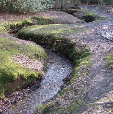
Explore the meanders of Hillwood Stream and then, using fieldwork equipment, collect measurements from different sections along a stream including height, depth, width and speed, to draw up a cross-sectional diagram and label the different features of a meander.
The full day option would include more thorough measurements and a walk to the source and confluence, linking the geology and geography of the land to the amount of water in the stream. A field sketch of a meander will also be drawn.
Learning Objectives
- to understand how features on a meander are formed using geographical vocabulary: erosion, transportation, and deposition
- to undertake fieldwork to measure a channel cross section and the speed of the water
- to record findings on a graph
- to recap the water cycle
National curriculum links
Geography
Locational Knowledge
- name and locate geographical regions and their identifying human and physical characteristics, key topographical features (including hills and rivers), and land use patterns; and understand how some of these aspects have changed over time
Physical Geography
- describe and understand key features of rivers and the water cycle
Geographical skills and fieldwork
- use fieldwork to observe, measure, record, and present the physical features in the local areas using a range of methods, including sketch maps and graphs
Mathematics
Y5 Number
- round decimals with 2 decimals to the nearest whole number and to 1 decimal place
Y5 Measurement
- convert between different units of metric measure (centimetre and metre)
Y5 Statistics
- complete, read and interpret information in tables
- interpret and construct line graphs
- calculate and interpret the mean as an average


